

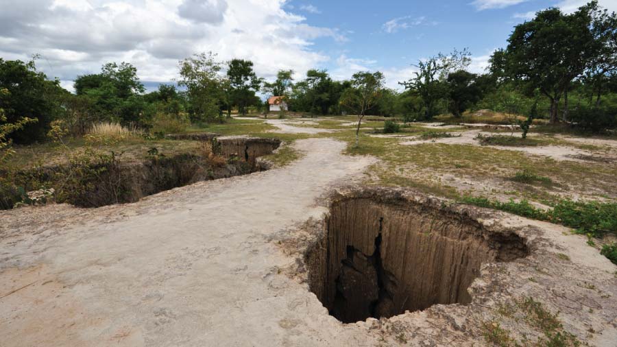
Subsidence is the gradual sinking or settling of the Earth’s surface, driven by both natural forces like soil compaction and human activities such as groundwater extraction and mining. Threatening more than two billion people globally, The effects of subsidence include cracked building foundations, reduced aquifer capacity, damaged infrastructure, increased coastal flooding, and habitat deterioration. With urban expansion leading to increased groundwater extraction and climate change intensifying drought conditions, the need to monitor and mitigate subsidence has never been more critical.
The role of field data collection in subsidence management
Effective subsidence management hinges on precise, timely data. Field data collection platforms, like Fulcrum, offer robust tools for gathering, analyzing, and acting on crucial information from the field. These platforms support the collection of various data types, including geospatial information, environmental measurements, and on the-ground observations essential for identifying subsidence patterns, assessing risks, and implementing mitigation strategies.
Essential features of field data collection platforms for subsidence management
Field data collection platforms are equipped with powerful features that are essential for managing subsidence risks effectively, including:
- Real-time data collection and synchronization. Real-time data capture ensures the latest information is always available, which is essential for tracking environmental changes.
- Geospatial data integration. Integrating GPS and other geospatial data allows for accurate mapping of subsidence areas. This integration is crucial for understanding the extent and impact of subsidence across different regions.
- Customizable data forms. Custom data forms let users tailor their data collection to specific needs, ensuring all relevant information, from soil moisture to structural integrity, is captured.
- Offline capabilities. Collecting data in remote areas with limited connectivity is possible with offline functionality, allowing data to be stored locally until it can be synchronized.
- Data analysis and visualization tools. Using the precise data collected by field data collection platforms in AI and BI applications helps planners analyze the information. Such analysis reveals trends, generates reports, and supports informed decision-making.
Applications of field data collection in subsidence risk management
Field data collection platforms are employed in various ways to tackle subsidence risks, such as:
- Monitoring infrastructure. Firstly, regular data collection on the condition of roads, bridges, and buildings can detect early signs of subsidence damage, enabling timely repairs and maintenance to prevent catastrophic failures.
- Environmental monitoring. Next, collecting data on soil composition, groundwater levels, and vegetation health helps identify areas at risk of subsidence, informing land use policies and conservation strategies.
- Disaster response and recovery. Rapid data collection following subsidence events is crucial for assessing damage and planning recovery efforts. These platforms streamline the process, providing responders with the data needed to prioritize actions and allocate resources effectively.
- Urban planning and development. Finally, integrating subsidence data into urban planning ensures the construction of new developments on stable ground. This approach mitigates future subsidence problems and protects infrastructure investments.
Future directions in field data collection for subsidence management
As technology evolves, field data collection platforms are becoming even more powerful. Future advancements may include enhanced sensor integration, advanced data analytics powered by artificial intelligence, and increased connectivity through the Internet of Things (IoT). These innovations will further enhance the ability to monitor and manage subsidence risks effectively.
Additionally, the growing use of satellite and drone imagery complements ground-based data collection. This combination offers a more comprehensive view of subsidence patterns. This multi-dimensional approach will enable more accurate risk assessments and more effective mitigation strategies.
Conclusion
Field data collection platforms like Fulcrum are essential tools in the fight against global subsidence. These platforms empower organizations to manage subsidence risks with unprecedented efficiency by providing the means to collect, analyze, and act on critical data. As environmental pressures and urbanization intensify, embracing these technologies is crucial. This approach protects communities, infrastructure, and the environment from the devastating impacts of subsidence.
Ready to take the next step in managing subsidence risks? Contact one of our experts today to learn how our solutions can empower your organization with the tools needed to stay ahead of these challenges.